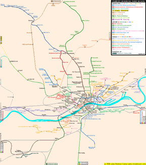
Suburban Railway (S-Bahn)
28-05-1978:
S1/S2/S3/S4/S5/S6
> Hauptwache - Wiesbaden Hbf
/ Niedernhausen / Bad Soden
/ Kronberg / Friedrichsdorf
/ Friedberg (+133.7 km)
30-09-1979: S3 > Bad Soden - Höchst
Bf (+6.6 km)
01-06-1980: (S8) > (Hauptwache)
- Hbf - Wiesbaden Ost -
(Wiesbaden Hbf) (+36.8 km) [former S14
and S15 routes]
28-05-1983: S1/S2/S3/S4/S5/S6/(S8)
> Hauptwache - Konstablerwache
(+0.6 km)
26-05-1990: S1/S2/S3/S4/S5/S6/(S8)
> Konstablerwache - Stressemannallee
(+1.2 km)
31-05-1992: S1 > Ostendstr.
- Mühlberg (+0.6 km)
27-05-1995: S1/S8 > Mühlberg
- Hanau Hbf (+19.0 km) [former S14 and
S15 routes renamed S8]
01-06-1997: S3/S4 > Stressemannallee
- Darmstadt Hbf (+29.0 km)
__-__-1999: S3/S4/S5/S6
> Messe station added
__-__-1999: S4 > Kronberg
Süd station added
28-05-2000: S9 > (Hanau Hbf)
- Bischofsheim - Mainz-Kastel
- (Wiesbaden Hbf) (+4.0 km)
__-__-2002: S3/S4 > Langen-Flugsicherung
station added
__-__-2002: S2 > Bremthal
station added
15-12-2002: S7 > (Hbf)
- Stadion - Riedstadt-Goddelau
(+14.3 km)
15-12-2002: S3 > Bad Soden - Höchst
Bf (-6.6 km) service withdrawn
06-11-2003: S1/S2 > Offenbach
Ost - Rödermark-Ober-Roden / Dietzenbach
Bahnhof (+27.6 km)
31-10-2008: S3 > Bad Schwalbach Nord station added
__-06_2010: S2 > Offenbach Ost - Offenbach Hbf (-2.1 km)
service withdrawn
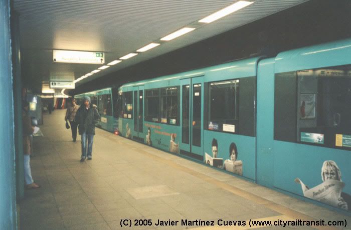
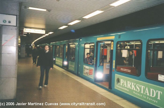
Light Rail (Stadtbahn)
04-10-1968:
A (U1/U2/U3)
> Hauptwache - Nordwestzentrum
(+9.0 km)
19-12-1971: A (U2) >
Heddernheim - Bad
Homburg-Gonzenheim (+8.5 km)
04-11-1973: A (U1/U2/U3)
> Hauptwache - Willy-Brandt-Platz
(+0.6 km)
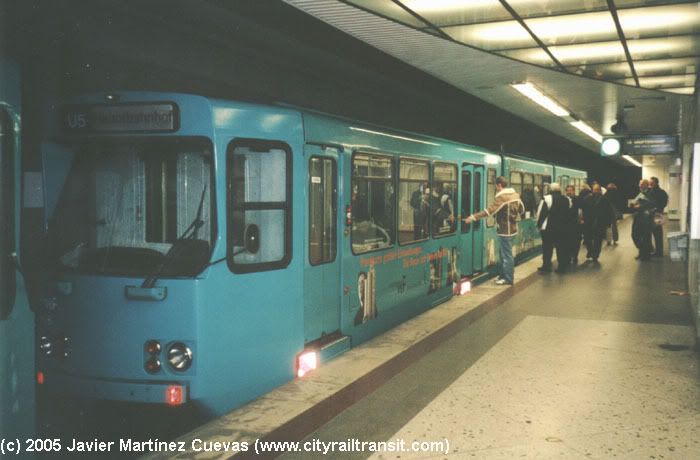
26-05-1974: B (U4/U5)
> Willy-Brandt-Platz - Konstablerwache
(+1.9 km) - Gießener Str. (+3.5 km)
29-09-1974: A (U1) >
Nordwestzentrum - Römerstadt
(+0.5 km)
06-03-1977:
U5 > Gießener Str.
- Preungesheim (1.7 km)
27-05-1978: U1 > Römerstadt
- Ginnheim (+1.4 km)
27-05-1978: U3 > Zeilweg
- Oberursel-Hohemark (+10.3 km)
27-05-1978:
U5 > Willy-Brandt-Platz
- Hbf (+0.7 km)
31-05-1980: U5 > (Hbf)
- Konstablerwache - Bornheim|Seckbacher
Landstraße (+3.4 km)
29-09-1984: U1/U2/U3
> Willy-Brandt-Platz - Süd
(+1.3 km)
11-10-1986: U6/U7 > Zoo
- Praunheim|Heerstraße / Hausen
(+9.0 km)
23-04-1989: U1 > Niddapark
station added
__-__-1989: U3 > Landstraße
station added
30-05-1992: U7 > Zoo
- Enkheim (+5.5 km)
__-__-1997: U3 > Rosengärtchen
station added
29-09-1999: U6 > Zoo
- Ost (+0.6 km)
10-02-2001: U4 > Hbf
- Bockenheimer Warte (+1.7 km)
12-12-2004: U6 > Ebelfeld station
closed
15-07-2008: U4 > Bornheim|Seckbacher
Landstraße - Schäfflestraße (3.1 km) [trial operation]
14-12-2008: U4 > Seckbacher
Landstraße - Schäfflestraße
- (Enkheim) (+3.1 km)
12-12-2010: U8/U9 > (Süd) / (Ginnheim) -
Niederusel - Kalbach - (Nieder-Eschbach) (+3.8 km)
Tramway (Strassenbahn)
Soon available
People Mover (Sky Line)
20-11-1994: Sky Line > Terminal 1A - Terminal 2D/E (+3.8 km)